League City sits at an elevation of just 21 feet above sea level, wedged between Clear Creek and the Galveston Bay system. When a client calls and says they’ve hit refusal at 70 feet but the bore log says otherwise, the conversation usually turns to seismic tomography. We run refraction and reflection surveys across the Gulf Coast sediments here to map what the drillers can’t see—paleochannels, buried clay lenses, and the top of the Beaumont Formation where it dips unexpectedly. In a city that added over 20,000 residents in the last decade and keeps pushing commercial pads into the floodplain fringe, knowing the velocity structure of the subsurface isn’t academic; it’s what separates a foundation that settles differentially from one that doesn’t. We often pair seismic tomography with SPT drilling to calibrate the velocity model against blow counts in the stiff Beaumont clays that underlie League City’s newer subdivisions.
Velocity contrasts in League City’s subsurface often map the boundary between Holocene bay clays and Pleistocene Beaumont Formation—a contact that controls settlement behavior.
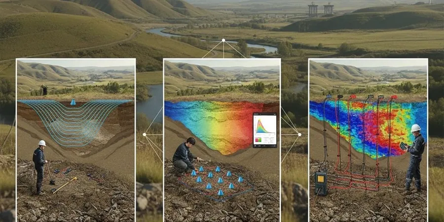
Local considerations
Here’s something we run into in League City more often than you’d expect: a developer hands us a geotech report with a single boring that hit sand at 15 feet, and they assume the whole 20-acre tract is uniform. Then we run a refraction line across the north end of the site and find a low-velocity trough running east-west—classic signature of a buried distributary channel filled with organic silt and soft clay, maybe eight feet thick. If you don’t image that, the pad gets built, the fill compacts differently over the channel, and within three years the slab has a crack you can slide a credit card into. Seismic tomography catches those lateral velocity changes that a boring every 200 feet will miss. In League City, where the near-surface stratigraphy is a mess of fluvial and bay-margin deposits from the Holocene transgression, skipping a geophysical survey is gambling with differential settlement. We also watch for velocity inversions—a soft layer under a stiff cap—that refraction alone can miss; that’s where reflection data or a parallel MASW line makes the interpretation solid.
Frequently asked questions
What's the difference between seismic refraction and reflection for a League City site?
Refraction maps the top of high-velocity layers—like the Beaumont Formation—by tracking critically refracted head waves. It works great to about 80-100 feet depth here. Reflection images layer boundaries by recording near-vertical reflections, so it can see deeper (300+ feet) and also detects velocity inversions that refraction misses, which matters when soft bay clay sits under a stiff crust. We often run both on the same spread.
Can you run a seismic survey in a tight residential lot in League City?
We can, but the spread length limits the investigation depth. For a typical 50-foot-wide lot, refraction will image to about 15-20 feet with a center shot. If you need deeper data in a confined space, we switch to a downhole seismic test in a single boring—it gives us a one-dimensional velocity profile that we can correlate with the neighbor's logs.
How much does a seismic tomography survey cost in the League City area?
For a standard refraction line on a League City commercial lot, you're generally looking at US$2,980 to US$5,430 depending on the line length, number of shots, and whether we need to auger geophone pilot holes. Reflection surveys with a land streamer run toward the upper end of that range due to the extra processing and deeper target imaging.
What do the velocity values actually tell me about the soil?
In Gulf Coast sediments, we correlate P-wave velocity to soil type: saturated loose sands and soft clays run 1,500-3,000 ft/s, stiff Beaumont clays hit 4,500-6,500 ft/s, and the Willis Formation or calcareous zones can exceed 8,000 ft/s. The velocity gradient is what matters—a sharp jump at 25 feet often marks the Holocene-Pleistocene contact that controls bearing capacity and settlement.